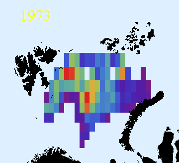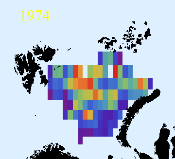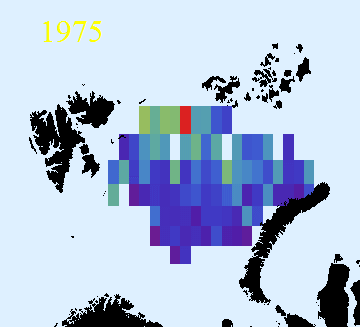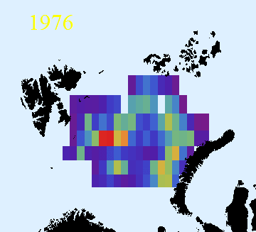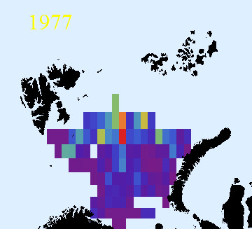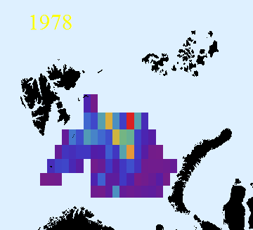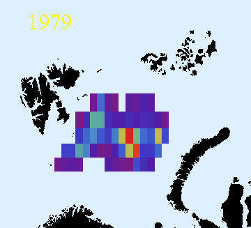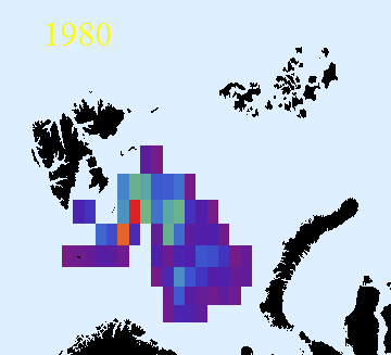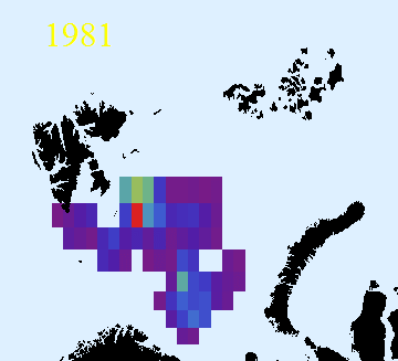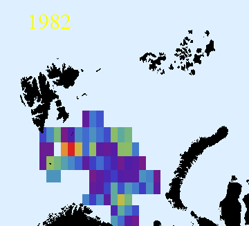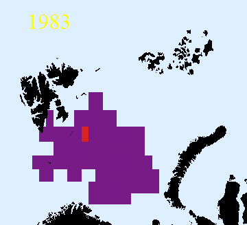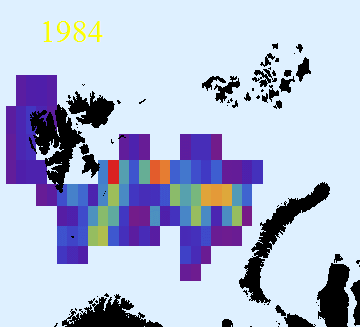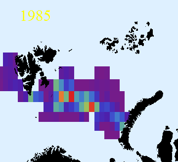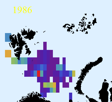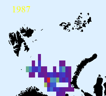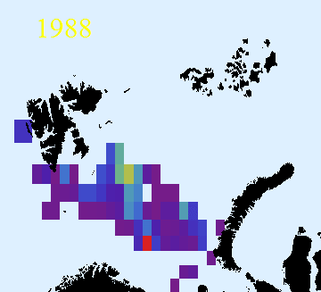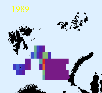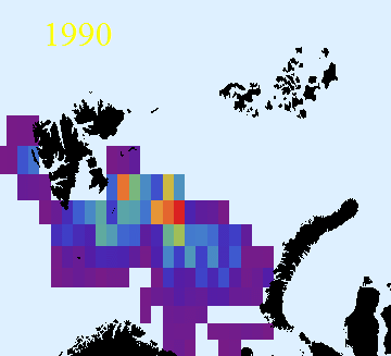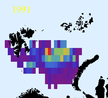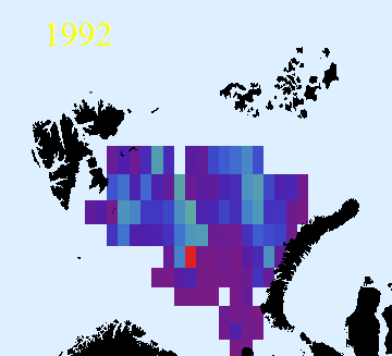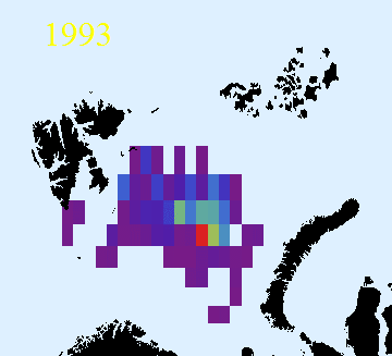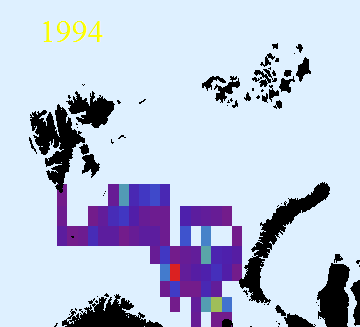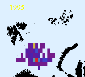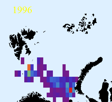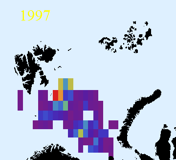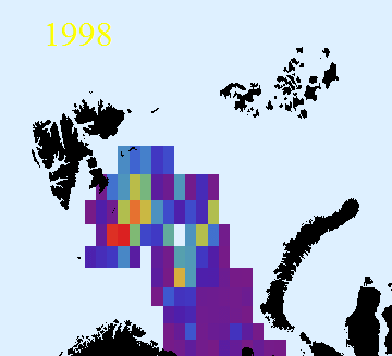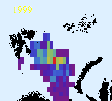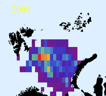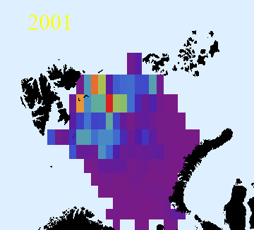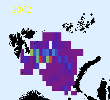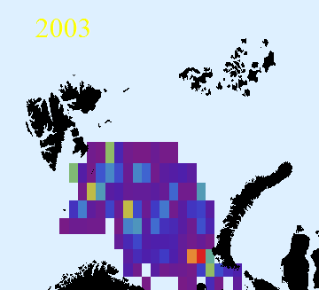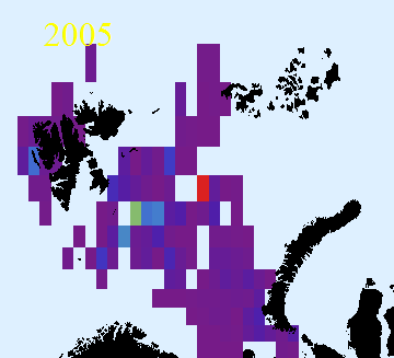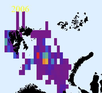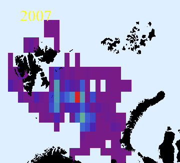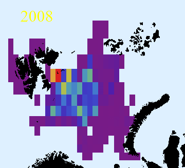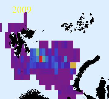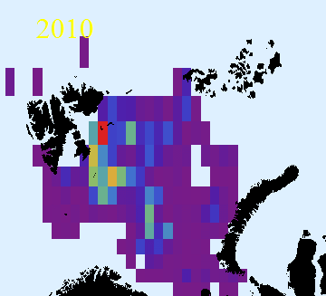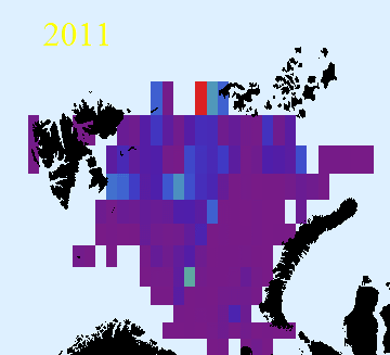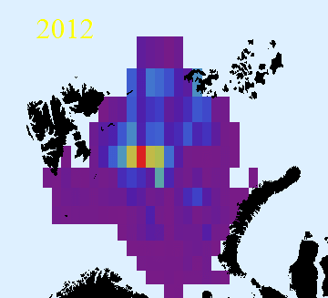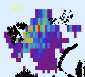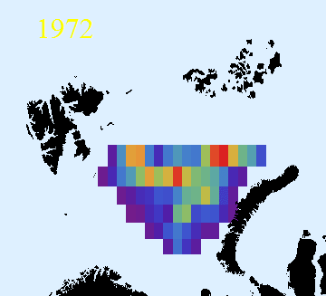
Geographical distribution of capelin in September
The consumption of capelin by cod and marine mammals depends largely on the geographical overlap between the species. Therefore it is important to study the geographical distribution of capelin. The abundance estimate of capelin made from the yearly survey in September is based on calculating the mean Sa-value in small squares. Prior to 1992 these squares were the statistical squares used in connection with the Norwegian catch statistics, from 1992 and later the squares are the more standard 2 by 1 degree WMO squares. The files of these data, called Rdata files, are a useful instrument for studying changes in the geographical distribution of capelin
Below, the distribution based on the Rdata is given from 1972. The colouring from violet to red (rainbow colours!) is based on relative values, where the square in which the mean Sa-value in a particular year is the highest is coloured red, irrespective of its value.